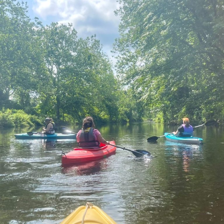
Souhegan River Trails
This section provides information about the Souhegan River paddling trails. If you have updates, changes, or recommendations to make it more correct or more helpful -- or if you observe a problem along the river, please contact souhegan.river.monitoring@gmail.com.
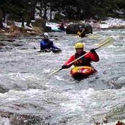
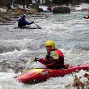
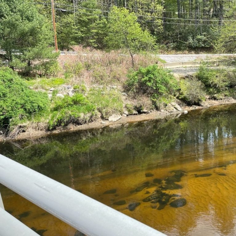
Boaters should assess their skill humbly before embarking on on a trip, especially during whitewater conditions. Boating with a companion is a good idea in case help is needed in an emergency. Wearing a PFD (personal flotation device or life jacket) is absolutely essential, for your own safety. By New Hampshire state law a PFD must be in the boat for each passenger.
Descriptions of Trips
Several of these trips can be combined comfortably in one day. Trips 1, 2, and 3 can be done in a long day early in the spring. Trips 6 and 7 are usually combined and available into the summer. The putin at Trip 8 offers low water paddling all summer long. All the times offered here are approximate.
Trip 1
Greenville to Rte 31 bridge - 1 mile - approx 1.5 hours
This is a popular early run for southern NH whitewater enthusiasts. There is a painted gauge on the side of the wall at the put in that is very hard to see until you are in your boat. A level below 1 will be scratchy; a level above 3 is very high. There is also a gauge on the left, downstream side of the Rte 31 bridge that is easier to see that roughly corresponds to the upper gauge.
Put in at the site of the old hydroelectric plant on a short side road off NH 31S just south of of the Wilton/Greenville town line. There is a sign saying, “Souhegan River Access.” Parking is available on either side of the road. Carry several hundred yards down the access road. The put in is just downstream of the very difficult, narrow gorge where a dam was removed in the early ‘60s. The rapids are rocky, with several small ledges, and they generate considerable waves in high water. Eddies are small, and rapids are continuous. There are two play waves on river left just above and under the bridge at the take out.
Trip 2
Rte 31 bridge to Monadnock Water at Rte 101 - 3.5 miles - 2.5 hours
Description: Class 2
Navigable: High water (late March to early April)
Scenery: Forested
This section of the river is a very popular run for whitewater canoes. Trip 1 is more suitable for kayaks. Parking is along both sides of this busy road south of the bridge. A painted gauge is located on the left, downstream side of the bridge best viewed from the opposite side. A “minimum level” line is indicated. Above 3 is high and will require care to avoid fallen trees and strainers that are bound to be there. At the lower levels you may have to avoid fishermen that enjoy this popular trout stream. Put in on a beach on the left, downstream side of the bridge.
There is an enjoyable playwave right below the bridge that boaters can enjoy while waiting for the shuttle to be set up. Below the bridge, the river follows the road closely for a while. The first drop is rocky, then the river becomes slightly easier, offering choices among the rocks.
Where the river turns away from the road, a huge boulder sits in the river to the right. A sharp left turn shortly below concerns boaters, but the large rock on the right, known affectionately as Bump Rock, has a pillow that makes it easy to miss. There is a large tree across the river shortly downstream that may be passable on the right.
At the large island, the left-hand channel is blocked by fallen trees. The right-hand channel has a ledge where a zig-zag course may be easier to plan after scouting. This ledge is the most popular playhole on the river.
Below the island, the river becomes easier, splitting again in several places.
Most parties take out on the left just above the Captain Clarke Bridge upstream of the Monadnock Water Company. Do not take out below the bridge on their land. They are not boater -- or river -- friendly. Walk out between the road and the fence upstream of the bridge on public land or the easier walk on the upstream side of the fence through John’s Cycles. They are friendly, but you may want to secure permission when you set shuttle if you’re concerned or have a large party. Shuttle parking here is off the road on the grass on the land in front of Monadnock Water. They have put up a no parking sign on the edge of their property that scares boaters, but the land between the sign and the road is public. Park in front of the sign off the road. Do not park on the triangle. Boaters may also take out a bit further downstream at the less convenient old NH 101 bridge.
Trip 3
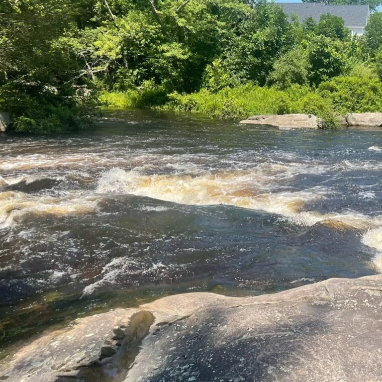
Monadnock Water to Downtown Wilton - 1.5 miles - 1.5 hours
Description: Class 3-3+
Scenery:
This section is called Trash Dump Rapids because the Wilton Recycling Center is on the right bank. But you may be too busy to notice.
From Monadnock Water to the Rte 101 bridge is easy Class 2. Class 3 rapids begin at the bridge and are more difficult than those in Trip 1. Paddlers must dodge rocks in a very swift current. There is a sharp Class 4 drop over a ledge called The Horseshoe, which is easiest to run or to scout on the left. There is .25 mile of fast water to the first dam in Wilton. Accomplished boaters sometimes run this dam on the right, but it’s best to take an easy portage on the left. Continue through .25 mile of rocky Class III rapids to a bridge and the mouth of Stony Brook on the left. The second dam s just below. Take out above the dam on the right into the parking lot of Label Art. This marks the end of the whitewater sections of the river.
From here, the river is dammed, diverted, and not worth boating until the bridge at the intersection of 101 and 101A, across from Granite Bank, known as Jones Crossing.
Trip 4
Jones Crossing to Boys and Girls Club - 3.5 miles - 2.5 hours
Description:
Quickwater up to Class 2
Navigable:
High water (late March to early April)
Scenery:
Forested, Rte 101A is seen in several places along the way.
Map:
Milford 15 Quadrangle (42071-G6-TF-024)
Put in on the upstream, left side of the bridge at the Rte 101/101A intersection. If there is enough water at the put in, there is enough water for this section. This is a winding stream with a fast current and a few fallen trees to Milford. Take out on the left at the Boys and Girls Club off Rte 13 in Milford. Good parking here.
To continue this trip, portage by car around the center of Milford. From the Boys and Girls Club, drive straight ahead at the stop sign where Rte 13 bears right into the Oval. Take the first right onto Souhegan Street and park near the Swing Bridge access path. From you must carry your boat about 100 yards east downstream to the dam. There a a good put-in just after the dam.
An alternative put-in with a shorter walk to the water is a bit further down the river by a power station. Take the dirt driveway just past the power station to get access to the water. This is private land that the owner allows boaters to use, so be courteous and don’t block any way.
If the Souhegan St put-ins look too rocky, here's an alternative: portage around the Oval to 101A/Elm St east toward Nashua; enter Kaley Park on the left next to the Milford Health Clinic. There are steps into the river.
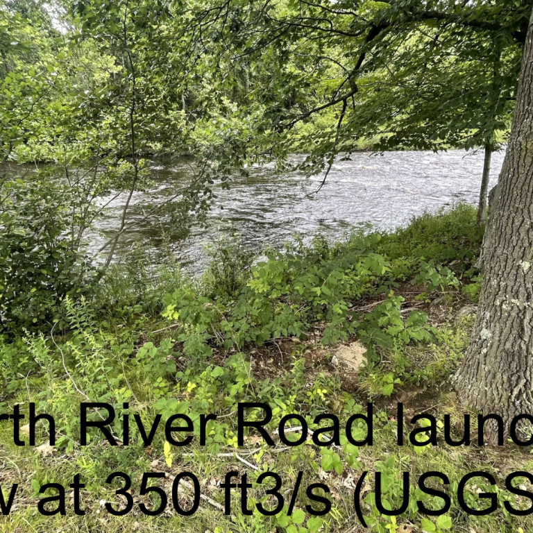
Trip 5 McLane Dam to Amherst Canoeport on Rte 122 - 2.5 miles - 1.5 hours
Description: Quickwater up to Class 2
Navigable: High water (spring)
Scenery: Rural
This section is all quickwater similar to Trip 4.
Just below Kaley Park the river splits around an island. The left side that was blocked with trees is now open (July 2016).
There is a small Class 2 wave beneath the high NH 101 bridge. This drop is best run on the right.
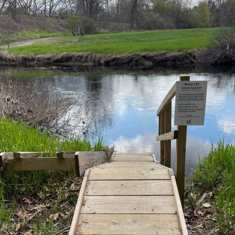
Expect to find trees across the river in various places that may require portaging. There are also several trees just beyond the drive-in theatre. Take out on the left just before the Rte 122 bridge, across from the golf course.
To drive to the take out, go to the north side of the Rte 122 bridge. There is a “Canoeport” sign and dirt road running parallel to 122 that leads to the parking area.
Trip 6
Rte 122 bridge to Amherst Canoeport at Boston Post Road - 2.25 miles - 1 hour
This section of the river and the next - as far as Severns Bridge-has enough water to be passable most of the summer.
The main feature of this section is the golf course. Kids especially and golfers will enjoy picking up golf balls lost in the shallow water and along the banks. Some boaters carry a net to pick them up off the bottom.
The river here has a sandy bottom and the river meanders all over the place. There is one oxbow on the right that is still passable when the water is high...but you probably won"t even notice it. Also, check out the unfortunate riprap erosion control along Brewsters Fields on the right.
The take out is marked by a set of wooden steps leading up to the parking lot. But pass the steps and take out just around the corner to avoid hauling your boat up the steep, eroded bank. As all along the river, watch for poison ivy.
To drive to the take out, take 101A east to the traffic light at the Timeless/Joey's Diner. Turn left. Turn left again in front of the white New England church. And turn left again. Take the left fork. This is Boston Post Road. Pass Souhegan High School and take a dirt driveway to the Amherst Canoeport parking lot on the right just before the bridge.
Trip 7
Amherst Canoeport at Boston Post Road to Seaverns Bridge - 2 miles - 1 hour
Description: Quickwater, flatwater
Navigable: Most of the year
Scenery: Forested, rural
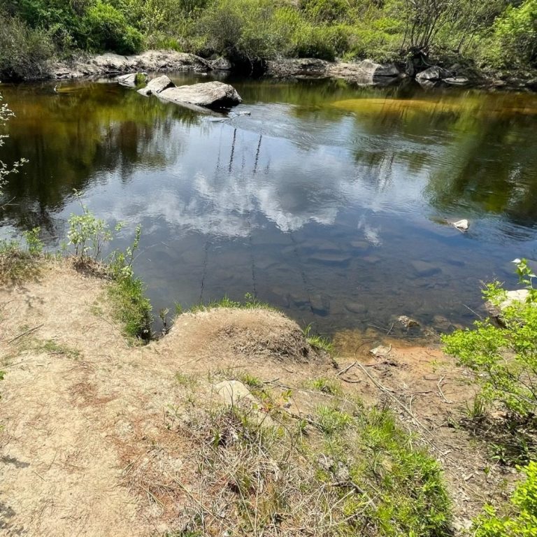
This is a good place to put in to paddle both upstream and downstream when the water is low during the summer.
This section of the river is a continuation of the last section. The river meanders around. There is often wildlife to be seen. When a few rocks begin to appear on the otherwise sandy riverbed, you’re approaching the take out at Seaverns Bridge. The take out is on the right just before the bridge up an eroded slope.
To drive to the take out from Boston Post Rd, cross the bridge and take the next right onto Thorntons Ferry II. Follow to the stop sign and turn right. Cross Severns Bridge and turn right. However, if you are combining this section with Trip 6 from Rte 122, follow the directions to Boston Post Road, but at the fork, take the right. This is Severns Bridge Road. Follow a couple of miles to the bridge.
Parking in the parking lot at the take out is possible for four wheel drive vehicles. Cars can park across (and off) the road.
Trip 8
Severns Bridge to Davidson Road - 2 miles - 1.5 hours
Description: Class 3, quickwater, flatwater
Navigable: High water in the spring/all summer
Scenery: Forest
Although high water is necessary to get all the way to the next takeout, this is the most popular spot to put in and paddle both upstream and downstream and back to your car during the summer.
About a mile after the put-in the river takes a sharp right turn. This is where to turn around and paddle back upstream during the summer. Durning high water you can continue downstream over a Class 2 ledge best run on the right. There is a big, red bard on the steep right bank. The pool below is above twor islands. Take out on the head of the right island to scout or carry. This is Indian Ledges.
Run down between the two islands and eddy on the right on the ledge. From here it’s an easy carry around the more shallow rapid ahead. If there is enough water, the rest of the rapid may be attempted, but expect to hit a rock or two. Staying center, left may be best.
One may take out or put in here from the end of Davidson Road, which is off Amherst Rd.
Trip 9
Davidson Road to Weston Park - 2 miles - 1.5 hours
Description: Flatwater
Navigable: All year
Scenery: Forested, rural
After the these rapids (Indian Ledges) it is mostly smooth water to Turkey Hill Bridge.
Take out on the right into the parking lot just before the bridge. This is Weston Park, a public access created with the support of the SWA.
Trip 10
Weston Park at Turkey Hill Bridge to Wildcat Falls - 1.5 miles - 1 hour
Description: Flat Water
Navigable: All year
Scenery: Forested, rural
There is a small rapid after about 0.5 mile - and a riverwide tree has been reported right in this area (5/22/17) so be careful. Otherwise this is a huge meander all the way to the falls. The falls should not be attempted by most boaters. The take out is at a clearing on the right. There is a small power line overhead.
To drive to the take out, go to the Merrimack DPW Garage on Turkey Hill Road. Drive all the way in alongside the furthest ballfield. Park under the powerline.
This marks the furthest practical place to go on the river. However, if you wish to either see Wildcat Falls (and it’s worth it) or to portage around, take out on the left side of the river. This is the Wildcat Falls Conservation Area in Merrimack. There are trails all through along the river. The opposite bank is an unattractive jumble of cottages.
Put in below the falls and there are several interesting Class 3 rapids in the short stretch under the Everett Turnpike bridge.
he Merrimack Village Dam at DW Highway was removed in 2008; however, shallow, sharp rocks preclude running this rapid. Take out on the right next to the gas station. It is not practical to portage further. There are only 200 yards of flatwater from the dam to the Merrimack River. Baboosic Brook enters on river left just before emptying into the Merrimack.
©Copyright. All rights reserved.
We need your consent to load the translations
We use a third-party service to translate the website content that may collect data about your activity. Please review the details in the privacy policy and accept the service to view the translations.